|
After leaving Yosemite we
drove through the park out to the east. I was amazed at how huge the
entire park area is, even though most of us only see the Yosemite Valley
area. The drive through the park to the east is beautiful and really makes
you appreciate how vast an area the park encompasses. There are limitless
areas for hiking and camping in Yosemite.
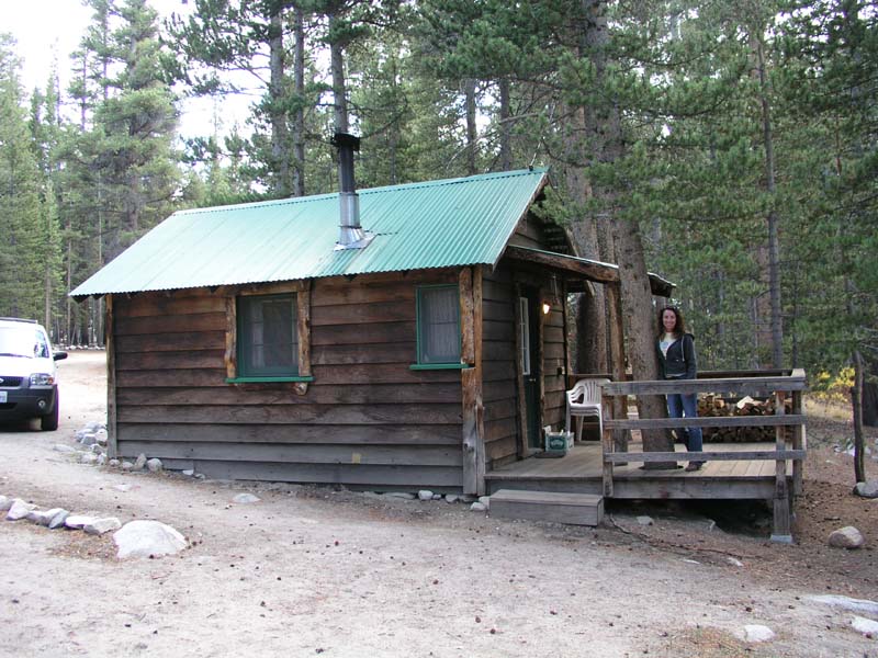
Our next stop would be Rock Creek Lodge near Mammoth Lakes, CA. Located
high in the mountains, Rock Creek would be an ideal altitude
acclimatization stop for us since we would be sleeping there at around
9,000’. The cabins are, however, a bit “rustic”. They did have
electricity, but the heat was derived from an old cast iron wood burning
stove and the bathroom and showers were in separate buildings. It was
still better than a tent though!
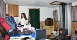
Our cabin at Rock Creek
Lodge:

We had lunch and dinner
about 30 minutes away in the town of Mammoth Lakes, which reminded me very
much of a high rent ski town like Vail. Every modern convenience is
available in Mammoth Lakes, so we ate well and took some time out to do
some laundry that had been accumulating.
Our cabin at Rock Creek was very cozy once we got the wood burning stove
lit and it was very peaceful.
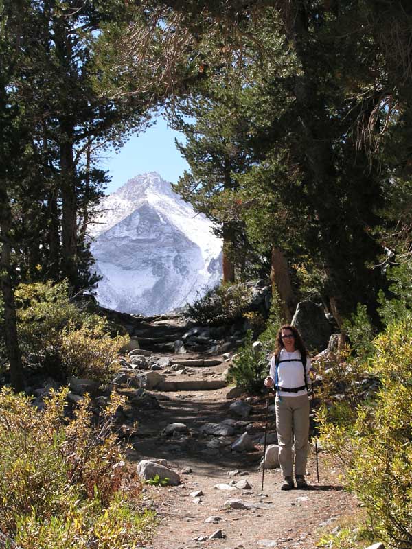
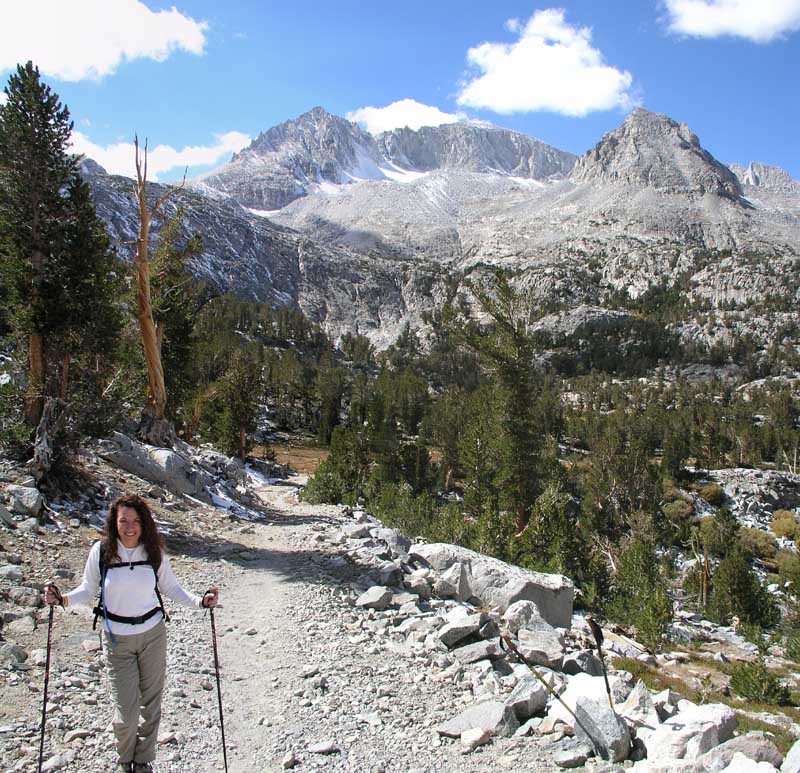
We awoke the next morning and had breakfast at the lodge which was VERY
good and picked up a few local hiking tips from some other guests. Instead
of hiking to Tamarack Lake they convinced us that a much more scenic 4
mile hike (8 miles roundtrip) along the Little Lakes Valley trail would be
much more worthwhile. Basically the trail wound up the middle of a long
valley into a large bowl of very high mountains (13-14,000 foot peaks)
toward a notch in the bowl called Morgan Pass (flanked by Mount Morgan).
It was an outstanding hike and I’m glad they opined that it would be a
more worthwhile hike.
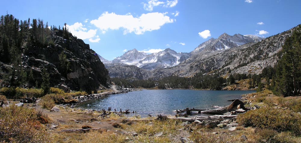
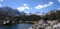
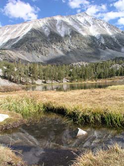
I can’t name many of the peaks in the following photographs, but does it
really matter?? This valley was so incredibly beautiful with lake after
lake and mountain after mountain.
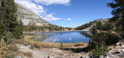
Heart Lake:
Marisa near a “hole” in the trail opening up near Long Lake:

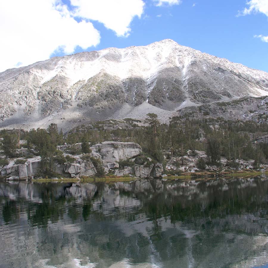
Mount Morgan guarding the left (north) side of the valley:

Chris along Box Lake:
Long Lake:

Marisa near the end of the 4
mile hike to Morgan Pass (11,100’):

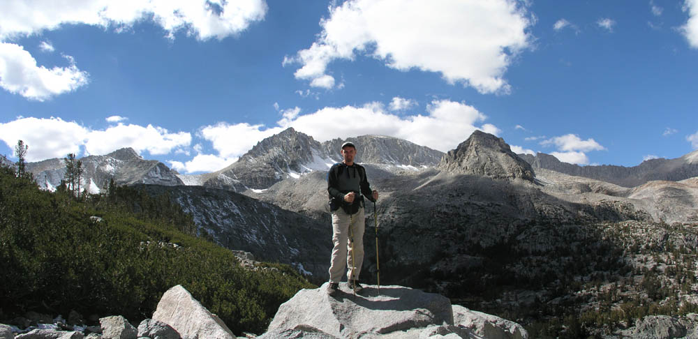
Chris on top at Morgan Pass:

Coming back down I caught Mount Morgan reflected in this lake:
The hike up and down Little
Lakes Valley was incredible, although it also revealed a bit about our
bodies too. Near Morgan Pass at 11,000 feet or so Marisa started getting a
slight headache. Both of us were suffering from tender knees and Marisa
developed a rather large blister on her foot.
Basically, we were already wearing our bodies down and we hadn’t even
gotten to the Whitney climb yet. We had hiked at least 36 miles on marked
trails in the previous four days, not including any incidental walking
around San Francisco and off-trail walking. I was confident however, that
even though we were wearing down our muscles, we were continually
acclimatizing to the altitude, which was the real foe on mountains like
Whitney and Longs Peak.
|
|
We hit the road early on
Day 6 of our trip to make drive to Lone Pine, CA which would be our
jumping off point for our attempt on Mount Whitney. We had spent the
evening prior packing all of our gear into our backpacks: tent, clothes,
gloves, food, mattresses, stove, fuel, etc., etc…
We arrived at the Mount Whitney Ranger Station in Lone Pine and picked up
our permit for the Mountaineers Route with no fan-fare and drove up from
the valley floor to the starting point for our hike, the Whitney Portal.
From the Whitney Portal the main trail winds its way up to the summit of
Mount Whitney from behind, while our trail (the MR) basically was a
frontal assault directly up the front of the mountain using gullies carved
out of the side of the mountain. I had researched the route literally for
months prior to this climb, getting route descriptions, pictures, and
advice from a multitude of people in person and on the internet. Many
thanks go out to the people who directly and indirectly helped us plan for
this trip!
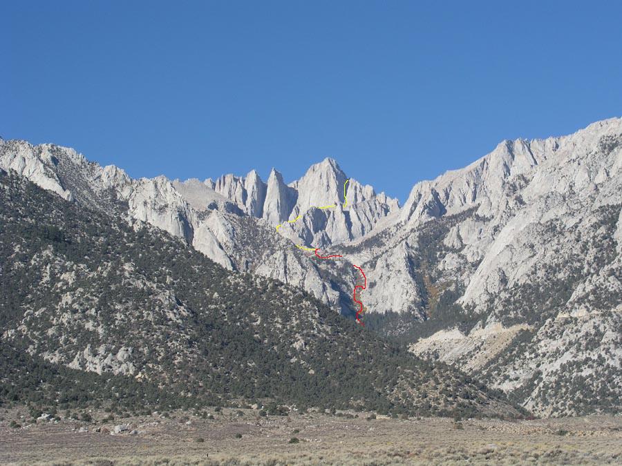
This photo, taken from Lone Pine (roughly 4000’) shows the Mountaineers
Route (very roughly..the actual route may vary significantly from what I
drew) up the front of Mount Whitney. From the Portal we would hike roughly
one mile up the main trail until the trail split with the MR taking us
directly up the gully that is formed by the North Fork of Lone Pine Creek.
The red line winds its way up the gully, crosses to the right side of the
gully and zig-zags once up what is called the Ebersbacher Ledges (the
E-Ledges). At the top of the North Fork gully you run into Lower Boy Scout
Lake, which you skirt counterclockwise to the left and climb up some slabs
to Upper Boy Scout Lake where we would camp on the first night.
The second day (the yellow line) roughly takes us from Upper Boy Scout
Lake to Iceberg Lake, then up a huge chute to what is referred to as “the
Notch” from which you can either traverse (walk along a steep slope) to
the rear of the mountain and climb up the sloped summit plateau or climb
directly up one of 5 chutes to the summit directly. We were planning on
doing the traverse since it seemed less exposed to a fall, but it was
something we would have to judge upon arrival at the Notch.

Now all of this seems
incredibly easy. From the picture, it looks like a simple walk up a few
gullies. Not that *I* felt it was like that, because I had been to Longs
Peak, so I had a lesson in scale. These pictures can in no way demonstrate
the enormity of the scale of these mountains. What looks like should take
you 10 minutes to cross ends up taking an hour. A ledge that looks only a
couple hundred vertical feet away is truly closer to a thousand. It is
just mind blowing to be there among it all and is awfully humbling.
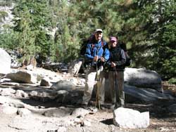
The beginning of our
hike/climb up Whitney:
So, permit in hand, we
start trekking up the Main Trail and eventually come to the North Fork
trail and start heading up the MR. The trail up the drainage is pretty
easy to find and stay on and only once do we get off the route when we
start seeking the E-ledges a bit too early.
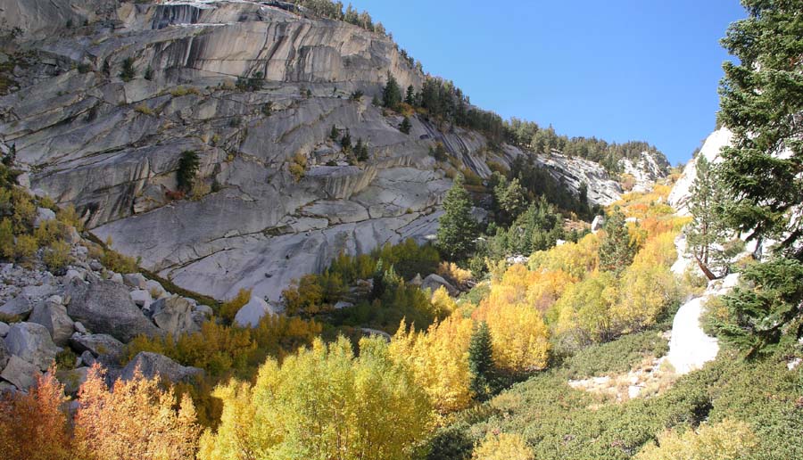
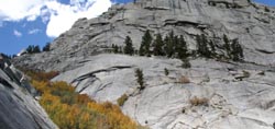
The North Fork of Lone Pine Creek drainage lies above us. The fall foliage
is awesome. Our first goal is to reach the top of this gully (it looks a
lot shorter than it really is!):

I consult both my written
reports and small photographs I’ve printed onto 4x6 cards and we soon find
ourselves back on the proper route approaching the ledges.
Now leading up to this trip I’ve read a lot about the Ledges. Some people
feel it offers the most exposure for the entire route. Basically you are
working your way up the canyon wall to give you a better approach to the
top of the gully and the exposure, while limited, is very real.
Looking across toward the Ledges from the far side of the gully reveals
the route we will take up them:
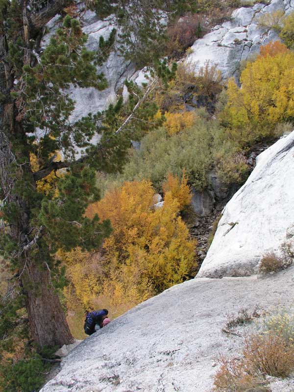
We find the entry to the
Ledges easily, but what I don’t realize is that the route I took initially
to get up to the “lone foxtail pine” was a bit too direct. I basically
headed right up the front of the ledge and climbed directly up to the
ledge above the tree, when in fact the easier and less exposed route is to
stay close to the wall and come onto the ledge from the side. While not a
problem for me, Marisa followed me up my route and found herself hugging
the rock while trying to find purchase on loose gravel that was
threatening to allow her to slide down the face and eventually into the
abyss. I quickly reached down and grabbed the back of her pack, assuring
her that she wasn’t going anywhere, but the feeling for her was one of
sheer terror that she was going to slide right off the edge.
Here she is approaching the point where we both went straight up above the
tree, when we should have been much further over to the right of this
picture (left if you are facing the way she is facing):

After a brief freak-out
session during which a few tears were shed and nerves were calmed we took
off our packs and munched on some food while we took stock. Here Marisa is
resting on the lower portion of the Ledges and we can see a lone figure
standing at the top of the drainage (where we are eventually headed):

Although it gets narrower
on the Ledges, we get smarter and stick to the safe pre-briefed route and
make it without incident the rest of the way up. Now it is just a slog for
the rest of the way up the drainage which eventually tops out and breaks
into a plateau consisting of Lower Boy Scout Lake (LBSL).
Click
here to continue to Page 3... |