|
California Odyssey Page 3... |
||
|
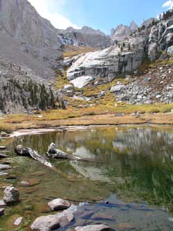
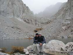
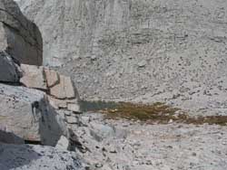
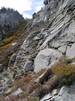
LBSL is stunning. We stop for a lunch break and heat up some canned Beef Stew (Dinty Moore!) which fuels us for the rest of the day: The lake is so beautiful and serene it almost seems like a hidden paradise. Trout occasionally break the surface of the lake and the crystal clear water allows us to watch them glide around underwater. Our path will take us further up the drainage to the left of and then eventually onto the large slabs in the center of this picture: Again, this picture is a lesson in scale, since it looks like it would only take 15 minutes to jaunt around the lake and up the slabs to the next lake (Upper Boy Scout Lake). In fact, it is a pretty long hike and the slabs just get bigger and bigger as you approach them. Hiking out west is always an incredible experience just for the sheer scale of everything! We eventually top out and step onto the large slabs following rock cairns built by prior hikers (a great route finding aid!) leading uphill to Upper Boy Scout Lake (UBSL). About half-way up the slabs the sky darkens, turns grey and soon a light snow is falling as we finish up on the slabs: I immediately start thinking about the possibility that maybe it won’t STOP snowing and the slabs will become entirely covered in snow (remembering how it snowed on Longs Peak!). The forecast at the ranger station didn’t call for any snow, but mountain weather can be fickle. It continues to snow all the way up to our stopping point at UBSL but it remains light and eventually tapers off to just a few flakes. Here we are, arrived at UBSL
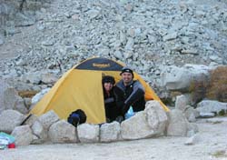
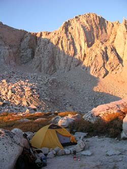
in the snow! We find a cozy little site that already has a rock windbreak built, although this mountain is totally unlike Longs Peak. There is barely a ripple of wind here and the silence is almost complete. We sort out our gear, set up the tent and start adding layers of clothing as the afternoon temperature starts dropping. We are no longer able to
see the summit of Whitney since intermediate peaks block our view. There
is another couple camping at UBSL and we walk over and introduce ourselves
and briefly compare notes. They seem well prepared for the conditions and
look like they are very experienced. The only cure for altitude
sickness is descending to a lower altitude. While altitude sickness around
10 to 12-thousand feet generally isn’t life threatening, it is a miserable
feeling, and being miserable both slows you down and may make one apt to
make mistakes. After throwing up Marisa said she felt a fair bit better
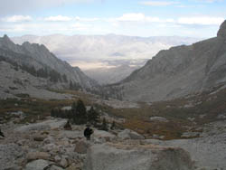
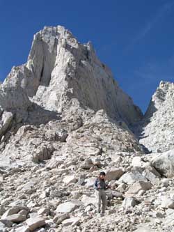
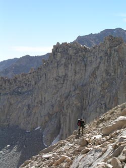
and that we should try to go up. Marisa and I started up the gully and made it as far as where it constricted at probably one of the tightest points. We had ditched our poles and were climbing using our hands and legs. The footing was pretty bad although the snow in the gully was minimal and we had finally worked our way over to the right side and were starting to get good traction on some of the large slabs. Noting our pace I made the decision to stop the ascent. I knew we could make it to the top. We would have made it to the top. And I wanted to go to the top. But, I knew that at our pace and more importantly our descending pace, we would likely not be back to our camp-site before dark. I had packed our head-lamps for that eventuality, and we had plenty of cold weather clothes in the pack, but I just didn’t want to risk route-finding in the dark. So at about 1/3 of the way up to the Notch we turned around and headed down. Marisa working her way back
down the gulley toward Iceberg Lake: On the way down the other couple that was camping near us at UBSL was heading up the extreme left edge of the gully, preferring to do more Class 3 type climbing on the slabs to slogging up the scree in the center of the gully. I wonder if they made it? |
Looking back down at Iceberg
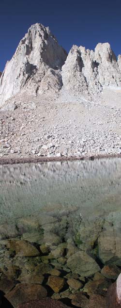
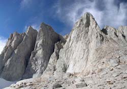
Lake on the way back down: After the grade mellowed a bit I turned around to take this picture of the sheer face of Whitney, the clouds were almost like a halo around the summit. This is a panoramic comprised of 2 pictures, one of Whitney and the other of Keelers Needles: We descended all the way
back down to our camp at UBSL, looked at our watches and determined that
if we hustled we could break camp and be off the E-Ledges by dark. With
Marisa recovering, but still sick, and both of use tired from our previous
weeks hikes, we packed up like banshees and headed down the trail in a
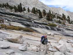
dust cloud! Marisa working her way down
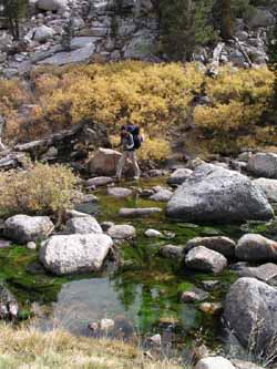
the slabs between UBSL and LBSL: Crossing the outlet of LBSL with the streamers of green algae waving in the current:
Off the Ledges and home-free, now we just have to make it to the Portal Store to get our hamburger before the grill closes! At the bottom of the trail, sunburned and chapped, but healthy and alive to hike another day! The hike was spectacular,
everything I thought it could be and more. I was surprised that Marisa got
altitude sickness again since we tried to improve over everything we did
wrong in Colorado. We acclimated more gradually with several days each at
5000 and 9000. She drank plenty of water and ate well. I was pretty much
unaffected by the altitude, so it must be a quirk of physiology that
prevents her from acclimating as quickly. After getting off of Whitney we checked
into the Dow Villa motel there at the base of the mountain in Lone Pine
and reveled in clean sheets and a warm shower.
We had a great trip.
Yosemite was the highlight since reaching the summit of Half Dome and
getting engaged was just incredible. An awesome location for an awesome
girl. I’m still reeling that she said yes! (She may have changed her mind
after that episode on the Ledges though!). The Rock Creek area was equally
impressive and Whitney just blew me away with both the size and
difficulty. Hiking Whitney is no easy feat and my hat goes off to those
that have done it (some people do it in a day!!). If you are interested in any of the hikes we did during our "California Odyssey" drop us an e-mail and we'll send you a free DVD that we made of our hikes. It is pretty entertaining with great still shots, music and video. Click here to return to our Main Page...
|
|

