|
California Odyssey September 28 - October 9, 2004 |
||
|
Last year Marisa and I went
to climb Longs Peak in Colorado. Marisa succumbed to altitude sickness and
fatigue just a few hundred feet from the summit (14,255’) on that trip and
I raced up and tagged the summit. This year we planned to acclimate better
by gradually stepping up the altitude over more days.
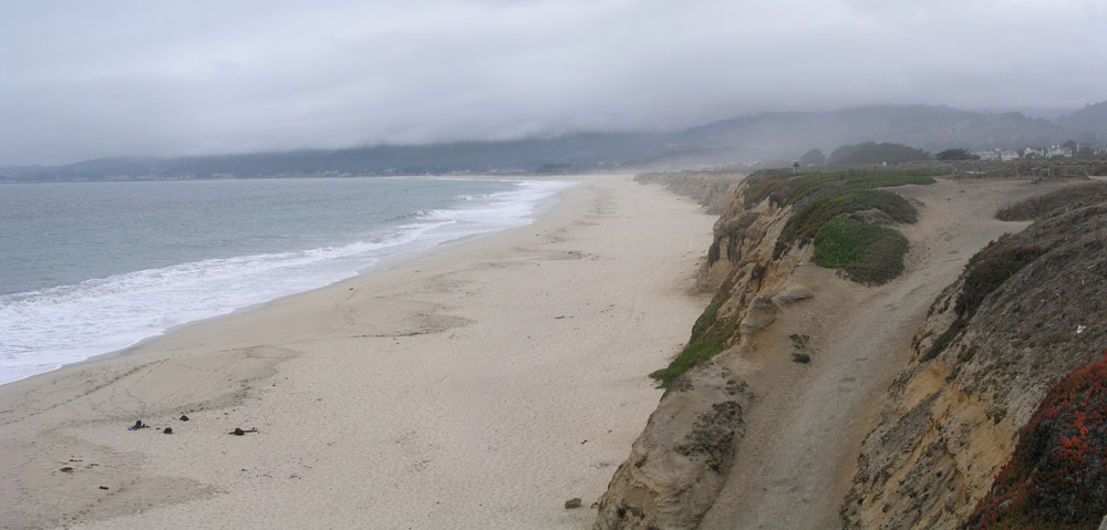
I’ve only seen the Pacific
Ocean in California a few times, but each time I’ve very impressed. The
Pacific is so beautiful with the green/blue waves which are much bigger
than our muddy brown east coast waves. The water is so cold though, it
made me shiver just looking at it.
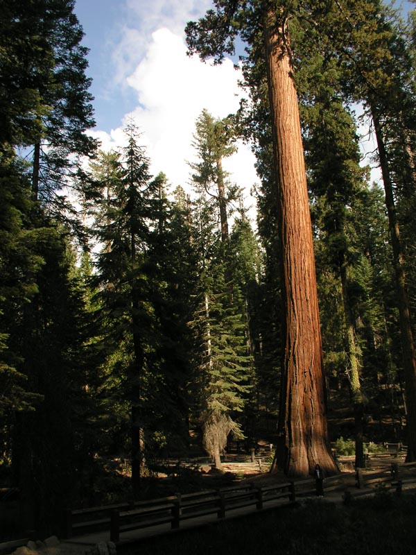
On our first afternoon at Yosemite we went to the southern end of the park and did a little warm-up hike of 7 miles or so among the “Big Trees”, the Mariposa Grove of Sequoias that are incredibly huge. Some of them are renowned for having tunnels carved out of their bases that are big enough for cars to drive though! Look how this tree dwarfs Marisa:
We grabbed a sandwich that
evening and returned to the Peregrine to get to bed early since we had a
big hike the next morning. Day 3 of our trip started in the wee hours of
the morning. This day we would attempt a long hike from Glacier Point in
Yosemite to the top of the notorious Half Dome. Our route was a bit longer
than the normal route since we weren’t starting at the valley floor. All
total we were looking at approximately 21 miles round-trip. As such, we
started before the sun came up using our head-lamps to lead the way.
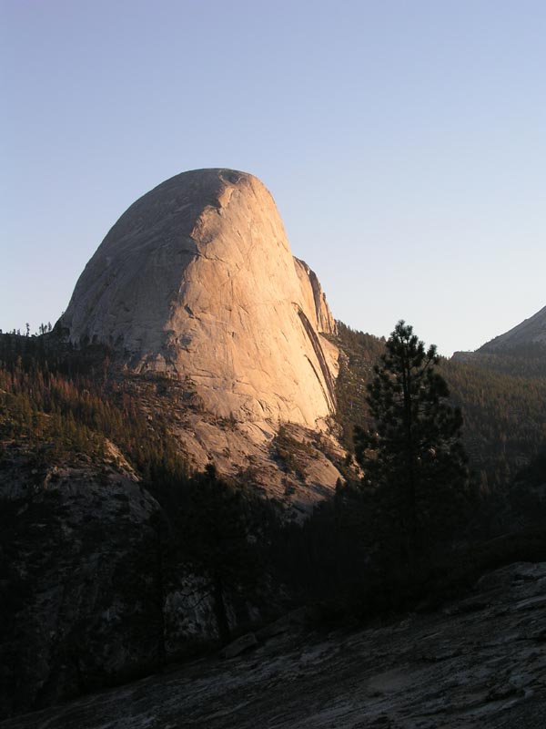
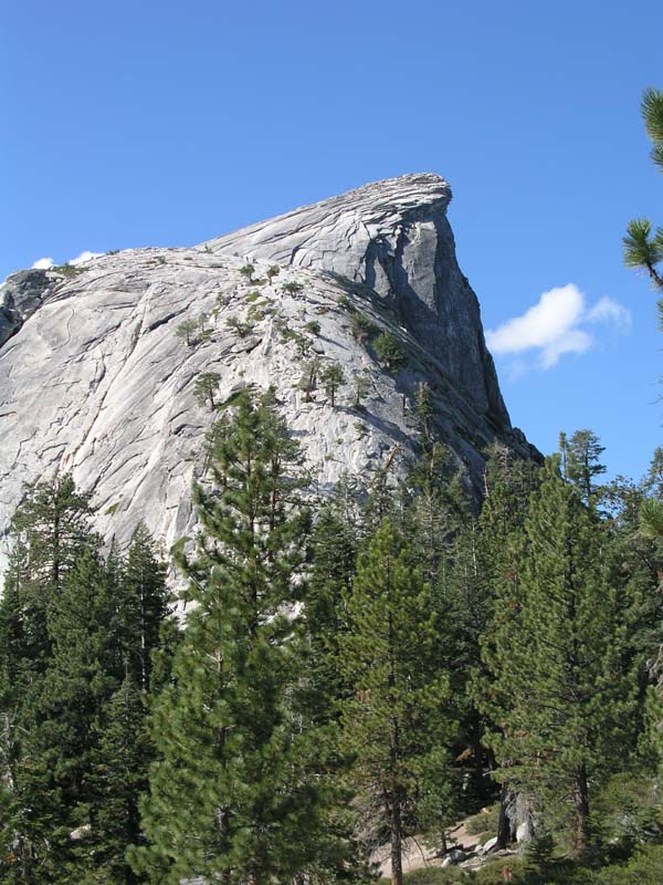
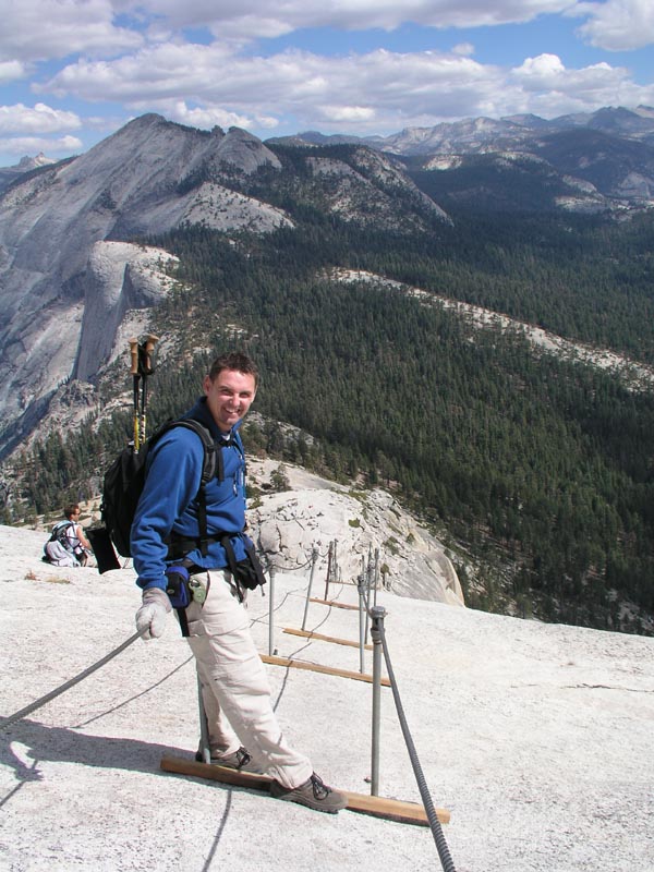
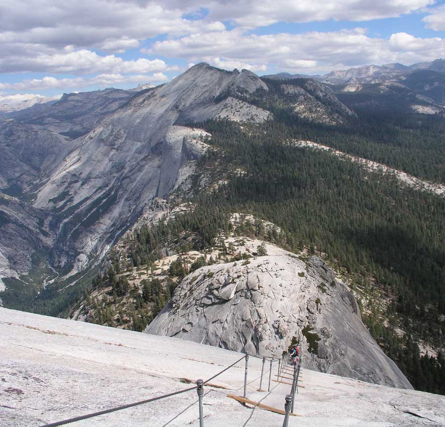
After many hours of up and down travel and beautiful sights along the way we finally joined up with the main trail that led to the summit of Half Dome. Interestingly, on the hike from Glacier Point we only saw one person the entire time, but as soon as we joined the main trail the path became much more crowded. Soon we had looped around to the back-side of Half Dome and after more than 10 miles of hiking had our first look at the formidable last bit to reach the summit. First would be a very tiring and arduous approach to the “dome” itself using a trail of rock “steps” that wound up the side of the mountain (if you look hard you can see people on the side of the mountain):
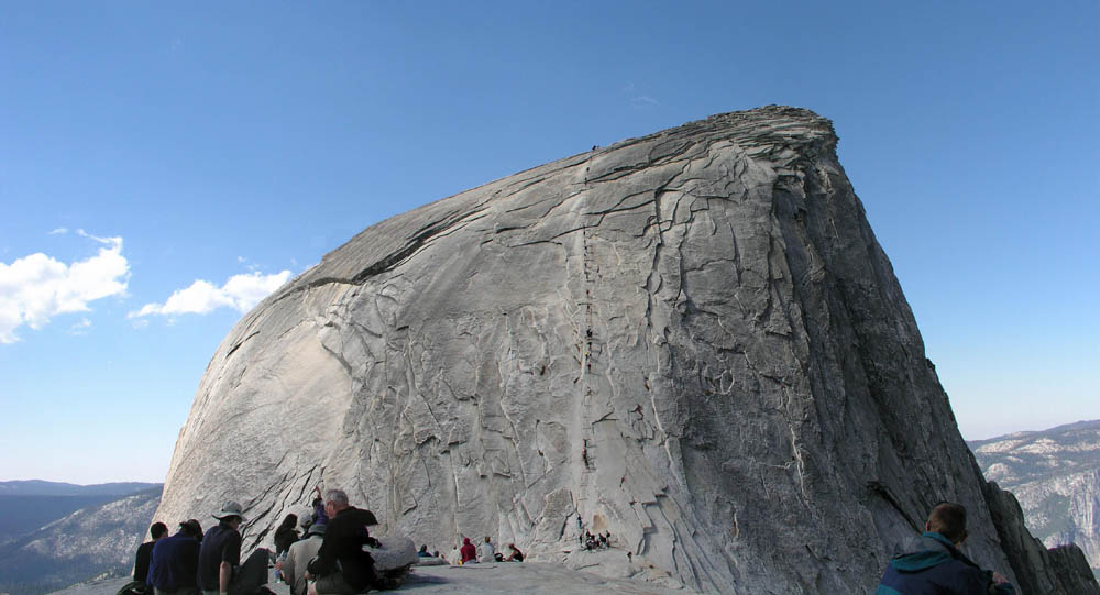
Soon after cresting the
approach to the “dome” you start seeing what looks like an impossible
climb up the side of the dome. Two cables run from the bottom of the dome
to the summit. Between the cables at roughly 15 foot intervals are boards
that allow you some purchase, but the majority of the time you are using
upper body to pull yourself up the side. It really is incredible and very
difficult to describe adequately. Standing at the base of it though,
looking at people working their way up the side you can’t help but think
that the National Park Service has a much greater faith in humanity than I
do! One slip and you are going to fall, there is no question about it. How
far depends on who you hit on the way down and if you fall straight down.
If you tumbled off the side I think it would be a long time before you hit
the bottom.
Seeing a bit of a gap in
the line of ants headed up the side of the mountain Marisa and I grabbed
some gloves that lay in a heap at the bottom of the cables and started
working our way up to the top. Despite the number of people that
accomplish this task every year without incident, I must say that the
exposure to a fall here is probably higher than anywhere I’ve ever been.
Of my own grip I was very confident, but that doesn’t keep the inertia of
Joe-250 pounder above me from breaking his fall on my skull. You can only
go as fast as the slowest person above you and many times you are stuck
sort of tenuously between boards on very slick rock using just your arms
to hold on with. Marisa was a trooper though and she made it up with no
problem. I can’t recall how long it took us to get up this segment, but
I’d guess it was somewhere around 20 to 30 minutes maybe?
|
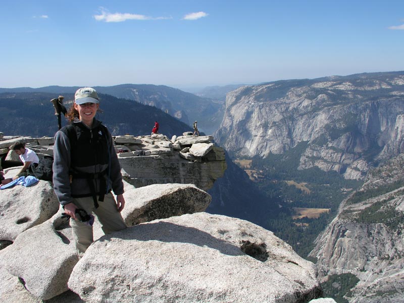
Marisa on the summit:
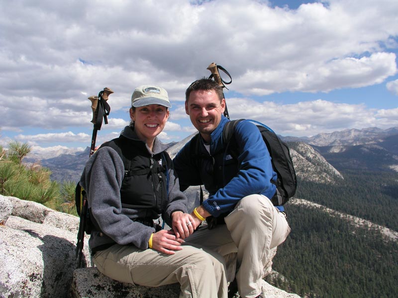
With the obligatory summit photos complete I led Marisa off to another area of the summit and told her I’d like to video-tape both of us on top. Her jaw about hit the valley floor when I got down on one knee, brought out an engagement ring and proposed to her! She started crying immediately and said “YES!” (can you believe it??). Our engagement photo:
It was awesome. Nobody knew
I was going to propose. Unfortunately, since I didn’t want to tip my hat,
I had to guess on the ring size, which turned out to be a bit too big, so
that will have to go back to get re-sized, but it was worth the surprise
factor! Chris at the top of the cables before heading down:
I opted mostly for going “outside” the cables since my backpack kept bumping into people on the inside of the cables. I found that staying on the outside I could grip the single cable with both hands and walk myself down rather efficiently. Marisa getting off the
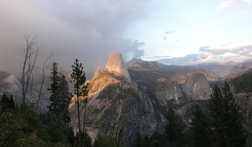
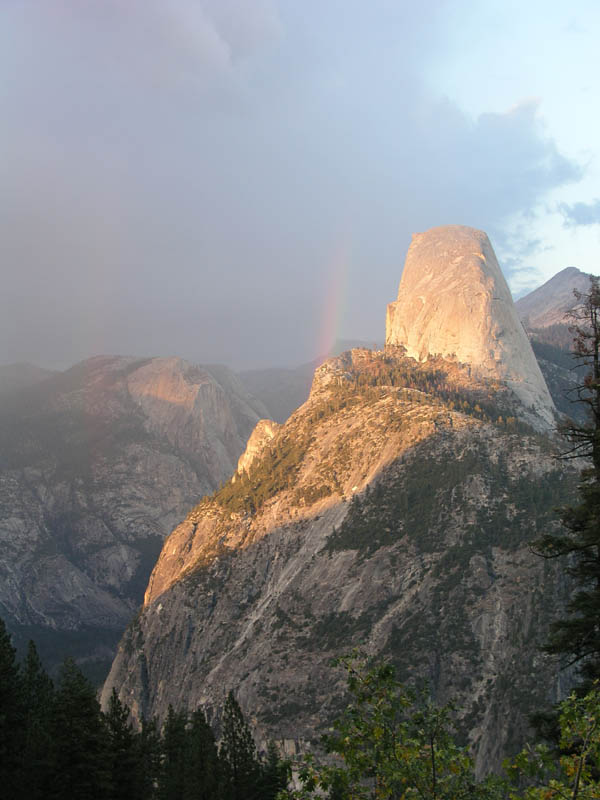
bottom of the cables: Now we just had to walk the rest of the 11 miles back to Glacier Point! It was a tough, long hike but as the sun started setting as we walked along the Panorama Trail and eventually approached Glacier Point the we were rewarded with beautiful views of the Valley and Half Dome with rainbows nearby:
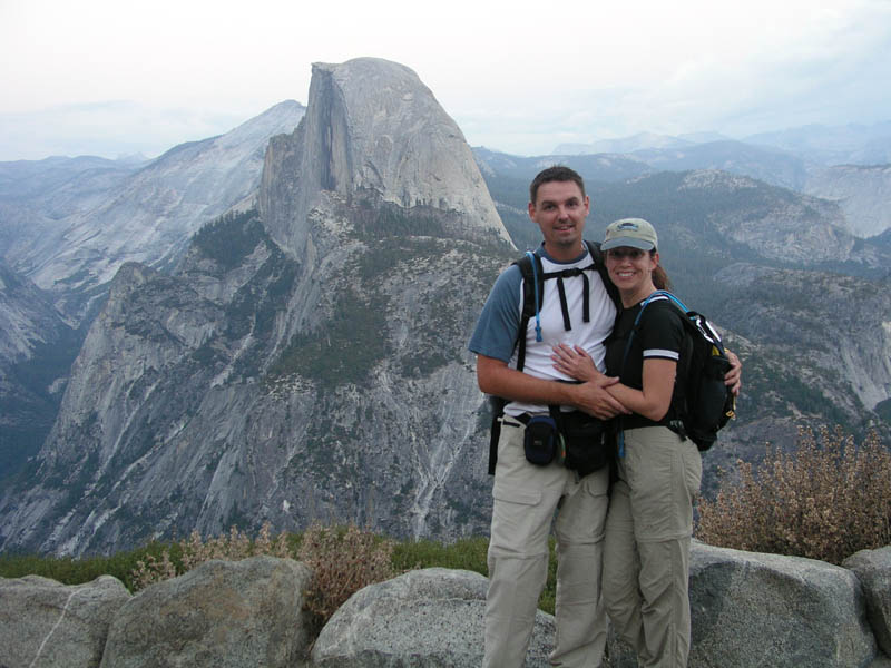
Exhausted, and in the last light of the day, we reached Glacier Point and took this last picture of our Half Dome hike (I kept the shutter open a long time, which is why it looks relatively bright!):
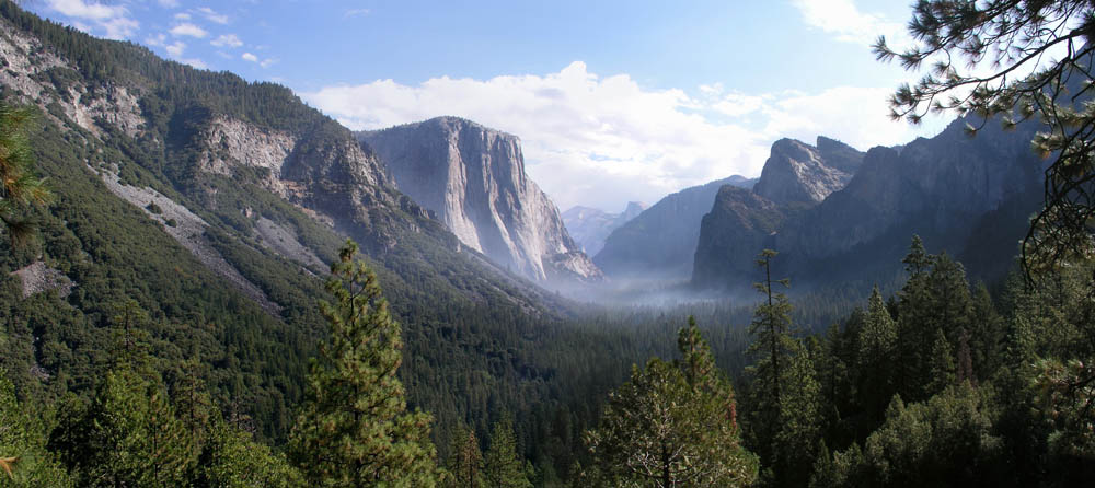
Needless to say, we were really exhausted. We had hiked for about 13 hours and we were starving! We headed down into Yosemite Village in the valley (about a 45 minute drive!) and sat down to an excellent large pepperoni pizza as a treat (I know, not the typical post-engagement meal!). The next morning we woke up and had an excellent breakfast cooked by Kay, packed up the rental car and headed out to go “over the top” of Yosemite to Mammoth Lakes, California. On the drive out we took this beautiful shot of Yosemite Valley with El Capitan on the left and Half Dome in the distance, the valley floor shrouded in smoke from a controlled burn:
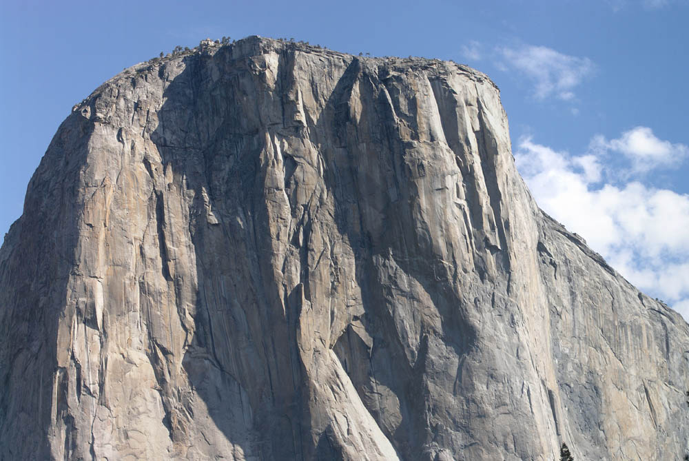
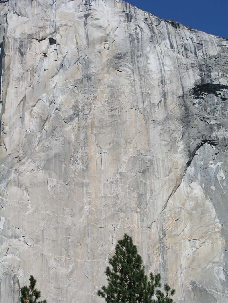
After scouring the wall for many minutes we finally picked out a two-man team roped up and ascending the wall. It was incredible! You can see them in this picture, just above and to the left of the top of the fir tree in the foreground:
|
|