|
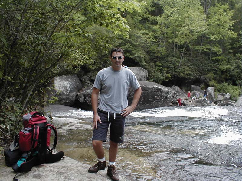
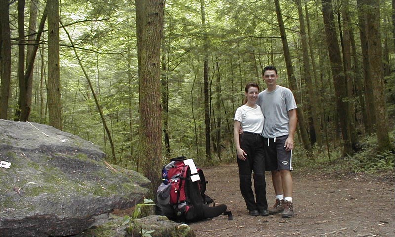
Gorges State Park - North Carolina May 12-14, 2001 This old trip report is special to me because this was the first hike that Marisa and I went on together. Although we somewhat look the part of hikers, we were pretty clueless. It's hard to believe she ever went hiking me again after these tentative first steps into the wilderness! |
||
|
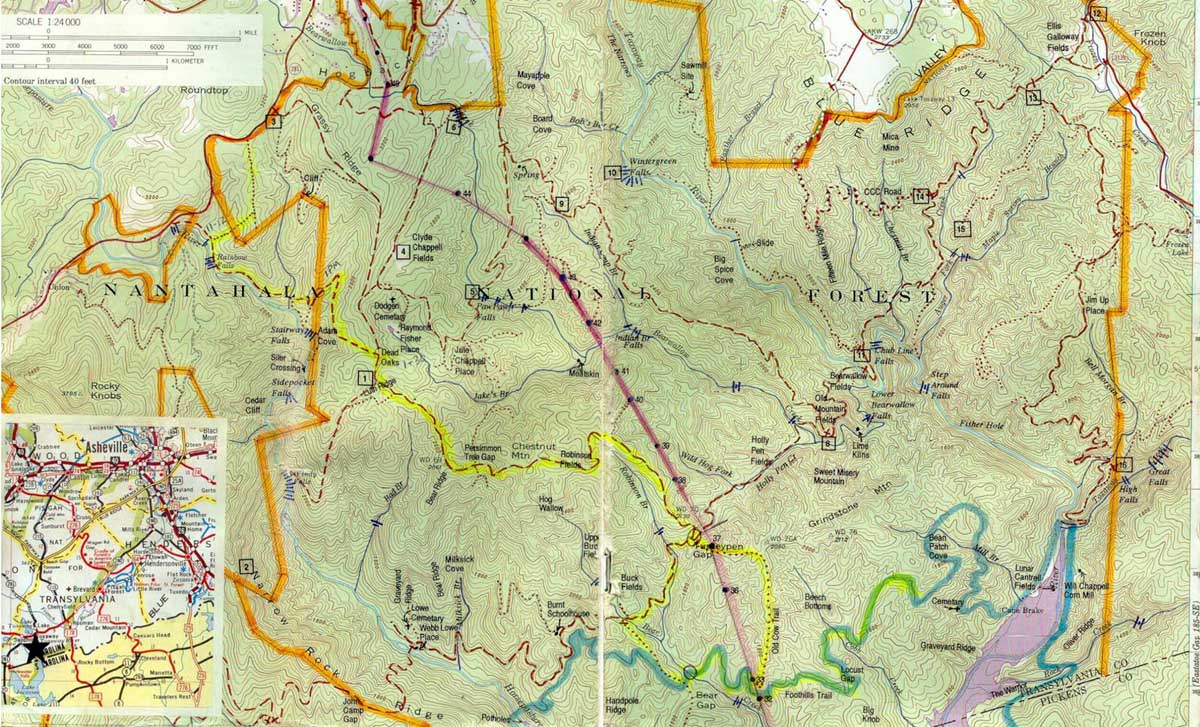
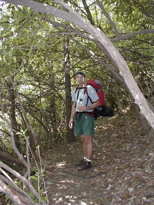
Always looking for something new to do, Marisa and I headed out for the mountains of Ashville over the weekend for some heavy-duty hiking. We decided on the brand new Gorges State Park based on the information we found on their web-site. Since it is a new park, there is very little in the way of facilities and the trails are not even marked yet. As such, a compass, a topographical map and a very valuable guide put out by the Sierra Club's Bill Thomas (hereafter referred to as "The Thomas Guide") were all that kept us on track over the course of three days. (click on pictures to expand..)
Our first day took us from the north-western corner of the park down along the Horsepasture River and the beautiful waterfalls.
The trail was quite narrow and overgrown with several dead-falls where storms had scattered debris across the trail. From along the river our course took us east into the interior of the park toward a juncture called Dead Oaks, appropriately named for a cluster of fallen oak trees. At Dead Oaks we took a south heading and followed the Grassy Ridge utility road. Many of the trails in the park are old hunting trails and utility roads that Duke Power uses to maintain some high-tension power lines that run through the park.
As you can see on the
contour map, the Grassy Ridge road runs very steeply down to a junction
called Turkey Pen Gap. The whole time we are going downhill we are
thinking in the back of our minds that if we have to go down this steeply,
we also have to come back up!! The downhill gradient was very tough on
the calves and Marisa's toes, but she was a trooper and we managed to hit
Turkey Pen Gap by about 5 PM or so.
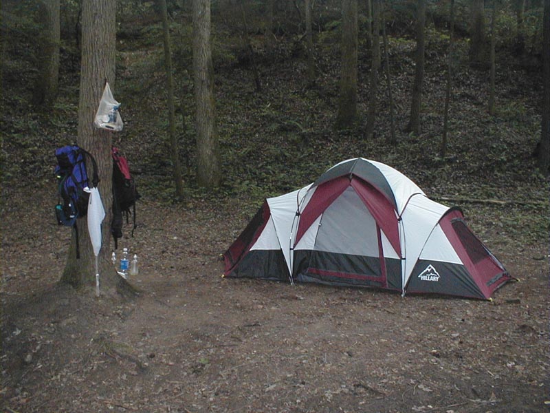
We quickly made camp and settled in for dinner. Soon we had a fire roaring and our stove cooking our meal. We both took the opportunity to take bird-baths in the stream and it was very invigorating as the water was very cold. Since passing the upper water falls about a mile into our hike we had only seen 3 people during our entire hike! A check of our map indicated we had hiked about 10 miles to reach our first camp-site.
Soon the sun dipped below
the mountain ridges to the west and it got very dark and chilly. We
bundled into our mummy bags and read by the light of the lantern until we
fell asleep. Day 2 We awoke the next day to a
beautiful, sunny and brisk morning and all our attendant aches and pains
from the previous days hike. Marisa was wise enough to have brought some
ibuprofen (good girl!) and soon enough we were up and about the camp
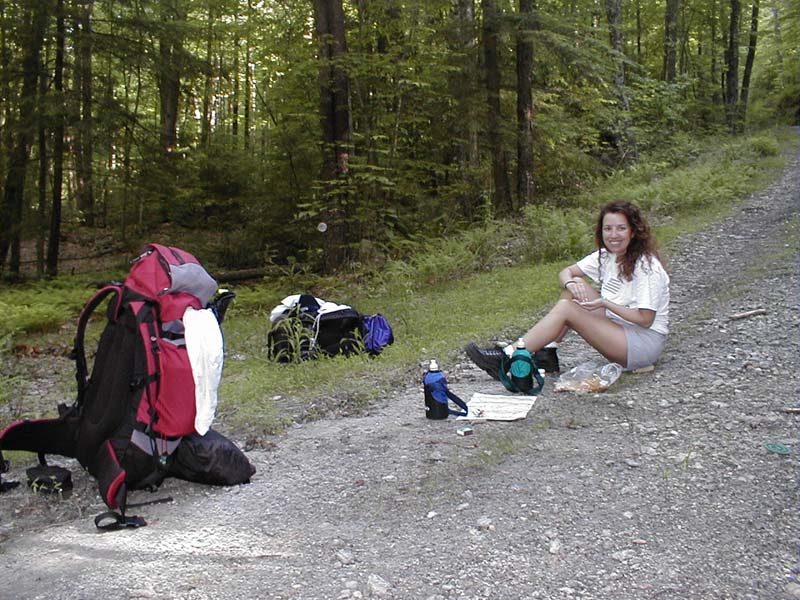
making breakfast. Planning for our three-day hike we had carried with us
about 4 liters of fresh bottled water. Water, by far the heaviest item we
carried with the exception of the tent, was very important to us. I had
planned to purify water taken from the stream at Bear Gap with iodine
tablets, but was unimpressed by the "garden hose" taste of the water after
purification. Instead we opted to boil all our water and we were
pleasantly surprised to find the boiled water to be as perfect tasting as
our bottled water.
|
Examining the Thomas Guide map I could see that the Foothills Trail, the power-line and the Old Cow Trail intersected each other all in the same place. Upon reaching the power-lines, Marisa and I looked left and continued down what we thought was the Old Cow Trail. The Old Cow Trail was supposed to head due north and parallel the power-lines for a mile or so before turning west and intersecting Turkey Pen Gap. As we continued down the trail I was noticing that the elevation was going down, not up, as would have been expected. In addition, my compass readings were showing more of a north-easterly heading instead of a due north heading. I chalked it up to the map being a bit inaccurate and perhaps not showing all the twists and turns on the trail. After passing a stream, my unease heightened even more since I figured that we might accidentally be on the Foothills Trail and that we were passing Cobb Creek. Something kept telling me to continue though, and that the trail would eventually take that west-bound turn. WRONG! Finally about 3 or so miles down the trail I concluded I had made a major blunder back at the power-lines. We had hiked 3 strenuous miles out of our way and had to hike 3 more just to get back to where we were supposed to be. My language reflected my mood <grin> but I wasn't laughing then! After
back-tracking to the power-lines I realized my stupid error had been in
not looking around completely when I reached the junction of the three
trails. Staring back at me was a clear path up the power-lines: the Old
Cow Trail. Muttering about my lack of navigation skills and very hot and
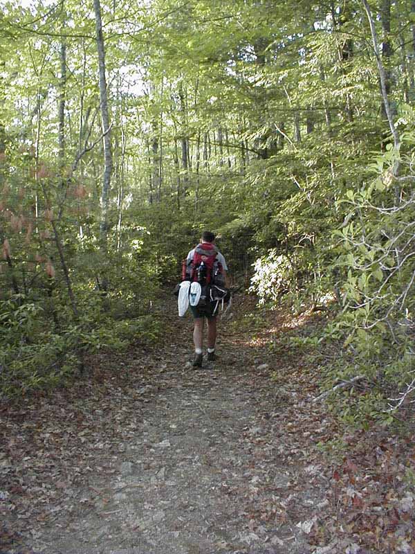
tired, we started up the Old Cow Trail, which was extremely steep and in
direct sunlight. It was so steep that we would climb about 20 steps or
so, then just pause for a minute to catch our breath and swig down some of
our water. Even though it was a very hard climb, it was nice knowing
without a doubt we were heading in the right direction this time.
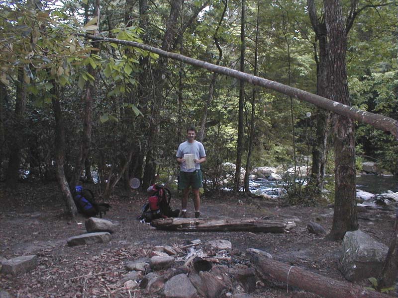
We reached our campsite just down river from Rainbow Falls about an hour before the sunset and shed our gear and made for the river for a nice cold bath. After cleaning up and getting a fire going we set up the tent and made ourselves dinner. The roar of the river was very soothing and we were happy with the knowledge that Day 3 would be a simple 3 mile or less hike back to the car and that we could goof off along the river the whole way back without worrying about the time.
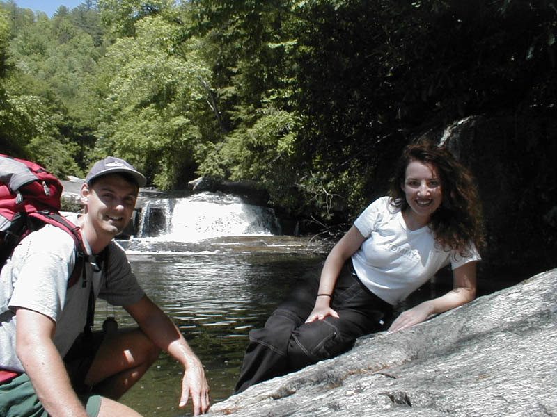
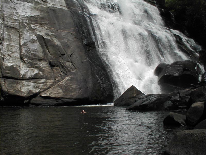
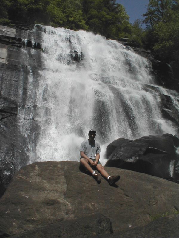
Day 3 Day 3 dawned bright and clear with perfect weather yet again. We had some coffee, boiled some more water to take with us and broke camp by late morning. We hiked up to Rainbow Falls and enjoyed a refreshing swim in the pool below the falls.
The view was awesome as the falls are probably a good 60 or 70 feet high. After our swim we laid out on the rocks and soaked up some sun in our bathing suits while the mist from the falls swirled around us. It really was perfect and both of us felt so relaxed and content it was hard to shake ourselves off and continue back to the real world. (We decided if it weren't for Mexican restaurants we really could live a Bohemian lifestyle..) We made the short trek back up the river toward the parking site, stopping to take pictures and were on our way back home to Charlotte by the early afternoon. What a great trip!
Thanks to all the great park rangers that gave us all kinds of tips and information and to the great state of North Carolina for providing us with such a beautiful place to hike. Click here to return to the main page....
|
|